


Noah's Ark has been (re-)discovered as early as 1959 to today's Western Civilized World. In a "battle for the truth" different parties have fought for different locations to be true. Among those the location with the remains presented below has substantiated itself as the real Ark of Noah.
It was in 1959 that a pilot on a NATO-mapping mission first photographed something strange on a foothill 15 miles south of Mt. Ararat. When Captain Ilhan Durupinar of the Turkish Air Force examined the photographs using a stereoscopic technique the object looked like it was shaped like a ship. An examination by a photogrammetry expert, Dr. Arthur Brandenberger of Ohio State, seemed to confirm that the object was foreign to the area. But what was a ship doing in the high mountains of eastern Turkey?


While routinely examining aerial photos of his country, a
Turkish army captain suddenly gaped at the picture shown above. There, on a
mountain 20 miles south of Mt. Ararat, the biblical landfall of Noah's Ark, was
a boat-shaped form about 500 feet long. The captain passed on the word. Soon an
expedition including American scientists set out for the site.
This site was discovered by Llhan Durupinar, a captain in the Turkish army. While reviewing aerial photographs taken for NATO's Geodetic Survey of Turkey, Capt. Durupinar was startled to see a ship-like form on one of the photographs. The subsequent announcement of this strangely shaped form caused a furor in the U.S. and European media, which led to on-site investigations. Noorbergen recounts the distressing developments preceding his, George Vandeman's and Don Loveridge's own expedition in 1960, which included Captain Durupinar, and resulted in a military escort and permission to investigate the site. This was the first scientific investigation of the Durupinar site. After two days of digging (and even usiing dynamite) inside the "boat-shaped" formation the disappointed expedition members found only "dirt, rocks and more dirt." The official news release issued by George Vandeman, the team leader, concluded disappointedly that "there were no visible archaeological remains" and that this formation "was a freak of nature and not man-made."
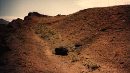
At 7,000 feet, in the midst of crevasses and landslide debris, the explorers found a clear, grassy area shaped like a ship and rimmed with steep, packed-earth sides. Its dimensions are close to those given in Genesis: 'The length of the ark shall be 300 cubits, the breadth of it 50 cubits, and the height of it 30 cubits,' that is, 450x75x45 feet.

A quick two-day survey revealed no sign that the object was man made. Yet a scientist in the group says nothing in nature could create such a symmetrical shape. A thorough excavation may be made another year to solve the mystery."

From: http://www.adiyamanli.org/agri.html
The Bible
There is only one verse in the Bible which gives us a hint of where we the
ark came to rest, "the ark rested...upon the mountains of Ararat."
Genesis 8:4. Where is Ararat? The name Ararat is a large area or ancient country
covering eastern Turkey, western Iran and western Russia. "The name Ararat,
as it appears in the Bible, is the Hebrew equivalent of ...Uratu, ancient
country of southwest Asia...mentioned in Assyrian sources from the early 13th
century BC" Encyclopaedia Britanica 15th ed. Some have mistakenly assumed
the Bible meant the ark came to rest on Mount Ararat (Agri Dagh), but that is
not the case. Mount Ararat is 17,000 feet tall, and is a post-Flood volcanic
mountain that gained its extra height after the Flood, therefore there is no
reason to assume it is a more likely candidate for the resting place of the ark.
The ark came to rest in the mountains of the ancient country of Uratu, not Mt.
Ararat.
The Historical Record
Flavius Josephus, c. 90 AD, the famous Jewish historian stated, "Its
remains are shown there by the inhabitants to this day." He quotes Berosus
the Chaldean, c. 290 BC, who indicated tourists would take home pieces of the
ark for making good-luck charms, "It is said there is still some part of
this ship in Armenia, at the mountain of the Cordyaeans; and that some people
carry off pieces of the bitumen, which they take away, and use chiefly as
amulets for the averting of mischiefs." These comments tend to indicate its
location would not be in an inaccessible area. At some point, the ark was
covered by a mud and lava flow which caused future generations to lose its
location.
The Dispute
Currently there are two main camps with regard to the Ark site. The
Creationist camp led by ICR (Institute for Creation Research, John D. Morris,
Ph.D, President, 10946 Woodside Ave. North Santee, CA 92071, USA) and similar
groups had been promoting the Mt. Ararat site for at least 30 years. As
Cummings' book shows, several 'sightings' of the Ark way up on the mountain are
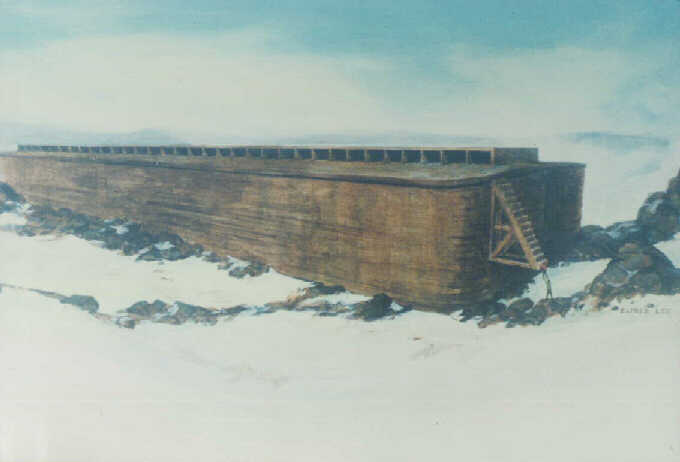
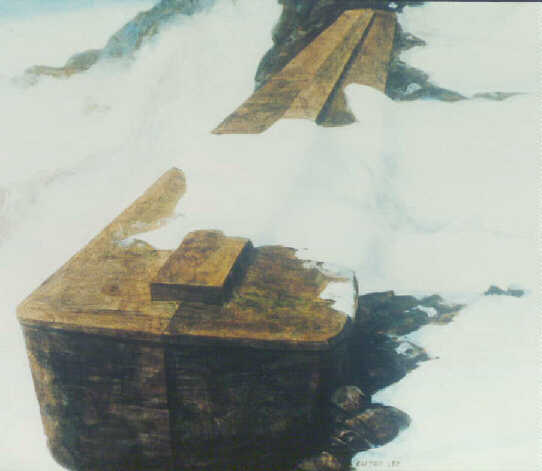
reported. Yet there is not one single photo to prove it. A sketch of the Ark,
broken into two pieces lodged at the end of an ice covered ledge is included in
Cummings' book, 1972 (see Bibliography) shown below.
Man is trapped: by rumors, illusions, lies and traps by the power of the
dark forces, the devil
Friends, please prayerfully consider the evidence you will see on Noah's
Ark. It may not be important or necessary for you to learn of this discovery,
but there are millions of people who need confirmation of biblical artifacts in
order to strengthen their faith in God. Satan is strongly attacking this and
other discoveries in order to deceive men of God's truth. All the false stories
about finding Noah's ark were invented by Satan to "muddy the water,"
and cause disbelief in the genuine.

Fantasy & fraud drawings by Alfred Lee based on a fantasy report of
George Agopian
In some cases the so-called eyewitnesses made up a story when lured by the interviewers with money. In other cases the description of the witnesses fit better with the alternate site. The alternate site proposed by Wyatt, Fasold and the Turkish government holds that the Durupinar site shows the correct Ark remains, and that the Ark is shaped like a boat.

From: http://www.adiyamanli.org/agri.html
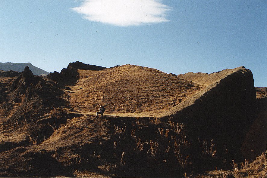
The 1960 expedition to the ark found a formation whose top sides were
even with ground level as seen in the photos above. The site researched by Ron
Wyatt is 18.2 miles south of Mount Ararat at the elevation of 6,524 ft., in the
"mountains of Ararat." A Turkish captain, Llhan Durupinar, was
reviewing NATO Geodetic Survey photographs of the area in 1959, and noticed a
boat shaped formation. Others in the U.S. then analyzed the photograph including
Dr. Arthur J. Brandenburger, world famous expert in photogrammetry, who said
"I have no doubt at all that this object is a ship. In my entire career I
have never seen an object like this on a stereo photo. Even the approximate
length of the object fits" The Ark File, p118. An expedition sponsored by a
party from the U.S. included among others, Rene Noorbergen, later author of The
Ark File; and George Vandeman, evangelist, and Dr. Brandenburger. They made a
visual inspection of the site and conducted no scientific studies, only some
digging and dynamiting of the ark and and mistakenly believed this site was just
an "odd geological formation." The expedition was expecting to find on
the surface of the ark "petrified beams" The Ark File, p126, by
digging in a few places. An article then appeared in the September 5th, 1960,
Life magazine, shown at left, revealing a very impressive aerial photo of an
extremely large boat-shaped object, plus two photos taken by the expedition.
Seventeen years later in 1977, Mr. Wyatt made his first of 24 trips to the ark,
and he was impressed that this really was the remains of Noah's Ark! In the
research he performed over the next 15 years, Mr. Wyatt successfully performed
metal detection tests and subsurface radar scans of the site, and he proved this
site really IS the mud-and-lava covered remains of Noah's Ark! (Another early
book on searching for the ark has some old photos you may like to view. The book
is The Lost Ship of Noah, by Charles Berlitz, 1987.)


Space Shuttle Image taken 9.14.94
http://volcano.und.nodak.edu/vwdocs/volc_images/img_ararat.html
Ararat is the largest and highest (16,940 feet, 5,165 m) volcano in Turkey.
Ararat is a stratovolcano
and is located at 39.7N, 44.3E. In this image, north is to the upper right. The
border with Armenia is 10 miles (16 kilometers) from the summit and is roughly
along the left edge of the image. Ararat has not erupted in historic time. The
most recent eruption was probably in the last 10,000 years. The volcano is
thought to be the resting place of Noah's ark. The observation of vessel-shaped
features in aerial photographs of Ararat caused a stir in the late 1950s.

This is a large section of the actual 1959 Turkish Air Force mapping photograph taken by Air Force pilot Sevkit Kurtis. The purple arrows represent a path of mud flows ending in a circle representing the ark area. The lower, white plateau section is Iran and below the escarpment (shadow of cliffs) is Turkey. Down in the upper, left-hand section in convergence of several mudflows, is seen the elliptical Ark remains. Nearly as long as two football fields the ark seems small in this photo but the distance from top to bottom of the image is nearly two miles. http://www.noahsark-naxuan.com/


 At
At
 t
t
Ron Wyatt determined that one day, he would visit the site and see for himself.
In 1977 Ron Wyatt took his first trip to eastern Turkey to pursue an interest in ancient history, archaeology and the Bible. Little did he realize that this would be the first of over 100 trips to the Middle East or that he would become the discoverer of some of the most sought after Biblical archaeological treasures of all time.
Before the end of this personal quest due to his death in 1999, Ron would be credited by many with finding the remains of Noah's Ark, the ashen ruins of Sodom & Gomorrah, the spot where the Red Sea Crossing took place, the real Mt. Sinai (not in Egypt but in Saudi Arabia), the location of the crucifixion site of Jesus Christ and hiding place of the Ark of the Covenant.


"Gopher wood"
"Gopher wood" is a misreading and scribal error. "Kopher" wood is correct and means wood (any wood) that is covered with Kopher. Kopher is bitumen. In the Genesis text (6:14), the context is clear. The GPR wood used, (a scribal error) is to be covered in KPR. G and K in Hebrew are so similar that inexperienced Hebrew "scholars," such as those translating the King James Version of the Bible, could have been prone to such errors, indeed, they made many such errors.
Acts 7: 45 & Hebrews 4: 8 are classic examples of such scribal errors.
gpr = "g," as in gopher, k pr = "k,"as in kopher
Here is a simple visual comparison of the letters, cross-reference your Hebrew language guide:

For a size comparison of the ark of Noah compared to the RMS Titanic.


Noah's Ark at 515 feet compared to the U.S.S. Kitty Hawk aircraft carrier. Graphics Mark Johnson, ArkFind.com The length of the ruins of the ark is 515 ft., which is exactly 300 Royal Egyptian cubits (20.6 inches)! Moses was schooled in Egypt and was not familiar with the Hebrew cubit which was not even in existence when Moses wrote Genesis.


Photo of our late-great friend, Dave Fasold leaning on one of the 12 or so,
flail-anchor stones discovered by the also late, Ron Wyatt at the village of
Kazan, 14 miles to the west of the ark landing site at Naxuan.
The Discovery of Noah's Long-Lost City - Mesha / NaxuanHigher up the slopes of Mt. Judi, seventeen miles south of, and in plain sight of the ark hunter's ever-popular Mt. Ararat, and just under the great white limestone escarpment wall known as Ziyaret, which means "shrine," lie the ruined remains of the ancient lost-city of Noah, called "Mesha" anciently, and known later as "Naxuan." In July 1997, the city was discovered by researcher and author, David Allen Deal. This small map of the center section of the ancient city is taken from a larger map which you may view on the following page. This map was created by Deal using photogrammetric methods from a Turkish Air Force aerial mapping photograph, taken in 1959 by pilot Sevket Kurtis (Dave Fasold gave Deal this negative about 1995 ). Captain Ilhan Drupinar first noticed the ark impression, while examining the photos and the rest, as they say, is history. 11 years earlier, however, Reshit Sarihan the Kurdish shepherd was in reality, the first to discover the ark in modern times. This high-resolution 20,000 ft. aerial photograph (not a satellite photo), allowed the discovery of the lost city by Deal, based on the assumption that the ark must have slid downhill from a higher location and then lodged in the descending mudflow near the village of üzengili 2 kilometers (just over a mile) downhill. In July of 1997 Deal, while searching the uphill source of a mudflow valley, noticed another impression, identical in shape and size to the lower ship-mold. This then, was the landing place of the ark after the great flood. Soon, building foundations began to show up under close examination of this area of the photo. In a few days, nearly a thousand house foundations had been identified. Mesha / Naxuan, Noah's city, had come to light after 4,500 years. |
House foundation
Photograph taken in 1998 by Professor Robert Michelson of Georgia Tech, on our first expedition to Naxuan, shows Dr. M. Salih Bayraktutan, associate professor of geology at Atatürk University, Erzurum standing within the foundation stones of one of the ancient dwellings at the Naxuan city center near the ark landing site, at an elevation of 7,400 feet above sealevel. |
Reconstruction
This shot is a reconstruction of the same house showing approximately how the walls and roof timbers looked during its original construction. This is not an actual building but a computer rendering by David Deal. It is assumed here that the ark was used as a souce of roof timber, furnishings, and firewood. (Click here or on the image for a close-up.) |
World's oldest post-flood city discovered.
This map is a small section of a larger map first published in 1997 in an Ancient American magazine article by Deal. If you wish to view a larger full-screen version |
In and around the ark discovery area, a new discovery is found by artist/author David Deal. The "House Map" that is shown here is a rendition of Naxuan's city map from a sattelite photo, in which (at certain filtering levels), foundations of buildings may be seen. Also, note the foundation build-up sequence at the bottom.

From: http://www.biblerevelations.org/ronwyatt/noahsark2.htm
Why Didn't The Ark Make MORE Headlines?
The world at large doesn't WANT to know the ark really existed, and therefore that the Bible is true. Just recently, when an Australian film crew visited the site and personally saw the metal detector scans performed, they didn't even film it. An eye-witness to the event said they only filmed what they thought would serve to discredit the site. It IS possible to twist and omit truths in a way which presents an overall picture that looks convincing, but is, in fact, a lie. Look at all the people who proclaim with a bold-face that men have never walked on the moon.
The "Blind" CANNOT See the Truth
Before the flood, without an annual cessation of water supply and with a constant temperature, the trees grew at a uniform rate continually. No growth rings were formed. But try and tell this to an evolutionist scientist. He simply will not accept it and therefore will never recognize the petrified wood at Noah's Ark as being wood. So here we have a perfect example of a promise given in the Bible: ROM 1:28 And even as they did not like to retain God in their knowledge, GOD GAVE THEM OVER TO A REPROBATE MIND, to do those things which are convenient;. When man rejects God and His Truth as HE told it through His Holy Word, God gives him over to Satan, that he will not be able to recognize truth. He will absolutely not accept it because through his rejection of Truth, he is blind. 2TH 2:11. "And for this cause God shall send them strong delusion, that they should believe a lie: 12 That they all might be damned who believed not the iruth, but had pleasure in unrighteousness." Sadly, this is a fact, so don't ever expect the world at large to accept the evidence God has so mercifully provided. But for those who DO want the truth, even though they may have been taught lies, their eyes will be opened. JOH 8.32. " And ye shall know the truth, and ihe truth shall make you free."
Artifacts Found in the Ark

Mr. Wyatt's tests show there is a grid-work of metal brackets and metal rivets throughout the structure. Inside the ark he found coprolites (fossilized animal droppings), a petrified antler horn (see photo below), metal waste or slag that was used as ballast in the boat, and Mr. Wyatt's very best piece of evidence is an 18 inch petrified deck timber, unearthed before Turkish officials, that is comprised of three separate layers of laminated wood! Radar scans show where the ark's singular eight ft. door is located in the right front, and the evenly-spaced rib timbers are visible along the earthen side of the formation, even though they have suffered greatly from water damage and ice-fracturing over the past 4,300 years. The mountain on which the ark rests is interpreted as Doomsday Mountain.
Ark Excavated by God
The photo above shows the ark deeply embedded in the surrounding terrain. In 1978, when Mr. Wyatt was returning to Nashville, he prayed that God would send an earthquake to "excavate" the site. When arriving in Nashville the headlines read, "Earthquake in Eastern Turkey." The earth dropped from around the sides of the ark, defining the formation more clearly and making it more accessible for research.
Metal Used in the Ark!
The ark contains a large amount of metal fittings used to
secure the large timbers together. These two photos below are from our
October 2000 trip to the site. Notice how there was once two large rivet
fasteners, but now only one is left. A large metal plate was positioned
behind the rivets. We received a positive metal reading when passing the
metal detector over the rivets. We should not be surprised to find metal
alloys used in the ark, because Genesis 4:22 states, "Tubal-Cain,
an instructor of every craftsman in bronze and iron."


(Left) Ron Wyatt found a beautiful specimen of one of the metal rivets used on the ark. It was tested and found to contain high-tech metal alloys, such as titanium, magnesium, and aluminum, etc. Critics have said Ron did not find this fine specimen on the ark but just manufactured it. Well, as you will see below, we found the same objects and had them tested. They too proved to have the same metals, in the same percentages! (Below) Two rough rivets in lower portion of photo.

Our Own Metal Samples Tested
Lab Report Shows Fossilized Rivet Contains Man-Made Metals!
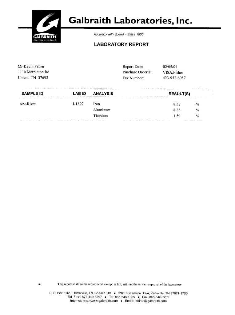

Below is what appears to be part of a large washer that would have been slipped over a shaft and then secured on the shaft by flaring out the end of the shaft. We have drawn circles on the photo to demonstrate the circular effect in the specimen. The surrounding material on the side of the ark around this object had a greenish color. Assuming a circular shape, this sample would be the same size as the rivet found by Mr. Wyatt. (Right photo of rivet as we found it on the ark)


Galbraith Laboratories of Knoxville Tennessee has tested the specimen for three metals we requested. We asked them to test for aluminum, iron, and titanium. It costs $60 to test for each metal requested. The results show 8.35 % iron, 8.35% aluminum, and 1.59% titanium. These results are similar to those produced in the analysis of the rivet found by Mr. Wyatt. Since the specimen is fossilized, it is assumed a large portion of it is now silica replacement, reducing the percentage of metal that was originally in it when it was made. These rivets are found in several locations on the outside of the Ark, and are probably buried inside the Ark by the hundreds or thousands. In comparison to others, this specimen is in poor condition.
Second specimen is also man-made!
Our second item tested by the lab reveals it to be man-made. It was found on the side of the ark. It gave us a positive metal reading with our metal detector when we were at the site. Later in Istanbul, we tested it with a magnet which produced an attraction to it. It appears to have been flared out (left photo) by pounding the center. The left photo is facing us the way it appeared on the starboard side of the Ark. Notice the side view (right view) which shows the tapering effect. Test results from Galbraith Labs, completed in June 2001, reveal it has man-made aluminum metal in it! It contains 8.08 percent aluminum, 8.24 percent iron, 1.34 percent titanium, and 3.82 percent magnesium. Click on thumbnail to read lab report.


Ballast?
Below is a suspected piece of metal ballast that may have been thrown into the bottom of the ark when the craftsmen were through forming metal brackets and had waste left over. Notice the concave features on almost every side, where other pieces of ballast were pressed against it when it was still hot. We will have this tested soon to find out its exact composition. (Two photos of same item.)


Metal Wedge?
This appears to be some manganese ballast which was poured
into the hull in a liquid state,
then hardened and took the curvature of the hull (right photo). It has a
coating on the convex side, while the flat side appears to be metal.


Ballast Found by Wyatt

This is an example of the metal ballast that has been found in the hull of the ark. It is made up of manganese primarily, which is a by-product of forming magnesium that was used in the metal rivets. Found by Ron Wyatt.
Square Object with "X" Impression
The western side of the ark had this square object that had the appearance of metal on its top and three sides.. It also contained an impression in it, much like it had been struck while it was hot. It was at a higher level where I could not measure it. It may have been 8 inches in diameter.

Ron Wyatt's initiative: Plotting the Metal Detector Scans
 Using
the 3 types of metal detectors, they did a scan of the site. At each metal
reading, they placed a rock, and then connected each rock with plastic tapes.
Before long, the shape of a ship could be seen in the pattern of the ribbons.
John Baumgardner, skeptical at first, soon began to show his excitement. After
all, it was the metal analysis of the specimen Jim Irwin had sent him that had
caught his attention. Another Los Alamos scientist would later tell Ron that
they suspected that perhaps a satellite had crashed in the region and that Ron,
ignorant of these matters, mistook it for Noah's Ark. John would be a great
asset to the team, if he ever became convincedat least that what Ron and Dave
thought. He had financial backing and his credentials were certainly impressive.
Using
the 3 types of metal detectors, they did a scan of the site. At each metal
reading, they placed a rock, and then connected each rock with plastic tapes.
Before long, the shape of a ship could be seen in the pattern of the ribbons.
John Baumgardner, skeptical at first, soon began to show his excitement. After
all, it was the metal analysis of the specimen Jim Irwin had sent him that had
caught his attention. Another Los Alamos scientist would later tell Ron that
they suspected that perhaps a satellite had crashed in the region and that Ron,
ignorant of these matters, mistook it for Noah's Ark. John would be a great
asset to the team, if he ever became convincedat least that what Ron and Dave
thought. He had financial backing and his credentials were certainly impressive.
At one point, when they were doing metal detector scans, John pointed out some metal flakes protruding out from the site of one of the metal readings, "I'd save those frames," he tells a jubilant Dave Fasold on video. Ron and Dave had an agreementsince it was so time consuming and nearly impossible to work and video everything at the same time, the two agreed to share their footage, an agreement Dave has honored. And so, when the trip ended, the three were all in full agreement that this was Noah's Ark and that radar scans were imperative.
June 20, 1987 - the Dedication of Noah's Ark
The dedication was set for June 20, 1987. In March, Ron signed an agreement with a local movie producer to make a documentary about the ark and his research. Arrangements were made just in time to get a crew to the dedication. But to be sure, Ron took his own video camera and had Dilaver film the events he couldn't personally film. Ron believed that God preserved the remains of the ark for a purpose, and it was certainly for more than just his own knowledge. But with the attacks both he and the site had received, he needed careful documentation. The dedication would just be another "story" without the event recorded.
They arrived several days before the ceremony and filmed as much of the region as they could, including the "Village of Eight," with the anchor stones. Then came the dedication. There, on the Mountainside overlooking the "now official" ark, were gathered a large number of dignitaries, from the local level to the national level, as well as high ranking military and many journalists. The plans were made public for a visitors' center to be erected on the spot where they stood. The governor spoke the dedication in Turkish and then he lifted the first shovelful of dirtthe groundbreaking of the new visitors' center. Ron was next, and after him, others. Banquet tables had been set up in the grass beside the ark and they retired here for a while, as Ron conversed,with the Governor, Mine Unler translating.
As things began to break up, Governor Ekinci asked Ron to do a radar scan on the site to demonstrate for the journalists the unseen structure beneath the earth.
A Timber on the Radar
 Governor
Ekinci issued instructions that the American crew was to stay upon the hill.
They were not to film this eventit was his. He allowed some journalists, a
Turkish cameraman, some members of the military, and other dignitaries only, to
witness the next events. Setting up the radar, Ron made several passes.
Explaining the printout to the group with Mine translating, he noted that one
particular reading appeared to be very near the surface. The Governor then
ordered one of the soldiers to dig at the location Ron had indicated, which he
did. There soon emerged what looked like a flat rock. As more dirt was removed,
it could be seen that it was about 18 inches long and it was then removed. All
captured on film, it was obvious that it was a petrified section of a hand-hewn
timber! Everyone was stunned, but most of all, Ron. For 10 years, he had wanted
to excavate but had never been allowed to retrieve anything that was not on the
surface. His dream had come true! Not only was it a section of a timber, but it
was almost perfectly preserved, showing the wood grain and perfect symmetry. The
Governor then did something that could only be directed by a Divine Handhe
told Ron to take it to the States and have it tested. He then placed it in the
radar case, which would protect the extremely valuable specimen during
transport. The entire event was shown throughout Turkey on TRT (Turkish Radio
and Television). It was a day Ron will never forgetnot in a million years.
Governor
Ekinci issued instructions that the American crew was to stay upon the hill.
They were not to film this eventit was his. He allowed some journalists, a
Turkish cameraman, some members of the military, and other dignitaries only, to
witness the next events. Setting up the radar, Ron made several passes.
Explaining the printout to the group with Mine translating, he noted that one
particular reading appeared to be very near the surface. The Governor then
ordered one of the soldiers to dig at the location Ron had indicated, which he
did. There soon emerged what looked like a flat rock. As more dirt was removed,
it could be seen that it was about 18 inches long and it was then removed. All
captured on film, it was obvious that it was a petrified section of a hand-hewn
timber! Everyone was stunned, but most of all, Ron. For 10 years, he had wanted
to excavate but had never been allowed to retrieve anything that was not on the
surface. His dream had come true! Not only was it a section of a timber, but it
was almost perfectly preserved, showing the wood grain and perfect symmetry. The
Governor then did something that could only be directed by a Divine Handhe
told Ron to take it to the States and have it tested. He then placed it in the
radar case, which would protect the extremely valuable specimen during
transport. The entire event was shown throughout Turkey on TRT (Turkish Radio
and Television). It was a day Ron will never forgetnot in a million years.
What Caused the Color Difference

This above section is at the front of the ship on the uphill section. The substances in the water which was flowing over the ship's structures and which effected its petrification were minerals from above the ship. These minerals consisted of silica from the soil, lime and calcium, to name a few. This gave the petrified structure a "whitish" appearance, compared to the petrified remains of the lower section of the ship, which featured a darker color due to the large amount of metals in them. We have 2 specimens of petrified wood, both about 6 inches long, both 2 inches wide and 1 1/2 inches deep. They are identical except for one thing- the piece which came from inside the crack near the front of the ship is very light colored, while the other piece is dark. They are both petrified wood pieces from the ship, only one piece's molecules were replaced by lighter colored substances than the other.
Over the past fifteen years, the Turkish government has cooperated with Ron
Wyatt in obtaining and evaluating structural specimens from Noah's Ark. One of
these specimens was a piece of fossilized deck planking, which many of you have
seen on the up-dated Noah's Ark videos. The most recent news in regard to this
specimen is that thin sections have been cut from this deck timber for
microscopic examination. As you can see in the photograph on photo page no. 5, a
corner section was cut off from this incredibly hard fossilized deck timber.
The Aramaic root word for the Hebrew word "gopher wood" seems to indicate laminated wood (this is when layers of wooden boards are glued together one upon the other to provide extra strength), and when these cuts were completed, it was plainly evident that at least this portion of the deck planking is laminated wood!
The excess of the cementing substance (the "glue" used was resin, which was made from tree sap) was squeezed out the end of the plank. hardened and has remained in the fossilized form. Until this cut was made, it was merely assumed that the dripping material along the outer edge was the pitch placed on the outer surfaces of the deck timbers and the rest of the boat. But now, the amazing fact has come to light that the construction methods used by Noah to build the ark included laminating.
June 1991, An Important Finding

 In
June of 1991, Dr. Roberts came to our home and spent some time delving into the
research in earnest. Then, he joined our tour group, which arrived in Turkey
June 12. At the site, as Ron approached it from the south end, a rock"
caught his eye, which he picked up. The tour group witnessed this, and was
astonished when Ron showed it to them. One side bore the shape of a very large
head of a rivet with a washer around it.
In
June of 1991, Dr. Roberts came to our home and spent some time delving into the
research in earnest. Then, he joined our tour group, which arrived in Turkey
June 12. At the site, as Ron approached it from the south end, a rock"
caught his eye, which he picked up. The tour group witnessed this, and was
astonished when Ron showed it to them. One side bore the shape of a very large
head of a rivet with a washer around it.
In earlier years, Ron had photographed what looked like groupings of metal fittings on the sides of the ark, but he couldn't disturb them by cleaning them off. Now, he felt he knew what these metal fittings looked likehe would know for sure when he had it analyzed.
Analyses of the "Rivet"
Richard Rives met some people who worked at an international corporation (with a local office near his home), that had its own metallurgy laboratory. This company specializes in titanium and offered to do lab analyses for us, which we were allowed to video-tape. We had already had other analyses run on the rivet, which revealed the presence of a very strange mixture of elements, which included iron, aluminum, titanium and vanadium, to mention a few. The metallurgy lab near Richard did some careful analyses on the specimen, taking samples from what appeared to be the washer around the head of the rivet, and then a sample just 1 cm. away from the washer, from the area we were theorizing would have been wood. In the final report, the chemist found it worthy to note in his report: " It is interesting to note that location 1 (presumably fossilized timber members) was found to contain much higher carbon (1.9%) than location 2 (presumably fossilized metal.") The 4 analyses they ran showed that location 1 yielded a 1.88% and 1.97% carbon content while location 2 yielded a .14% and .13% amount. And this certainly was important! When an object undergoes the process of fossilization, as it's molecules are washed away by flowing water, molecules of objects the flowing water has flowed over prior to reaching the fossilizing object, are washed in to fill the voids left by the washed away molecules. I know that's a mouthful, but its what occurs. Now, this water carrying new molecules to fill in the empty holes doesn't play favorites and places lots of "red" molecules in one place, and then very few "red" ones just one centimeter away. This may be noticeable over some distance, but not this close. So if some carbon molecules were washed in and filled the voids on this rivet, it was a fairly uniform processwe could expect that 14 carbon molecules in one location would equal about the same amount that was washed into the adjacent area just a
centimeter away. But to find 13 and 14 in one location, and then 1 cm. over, to find 188 and 197, tells us that a bunch of those carbon molecules in the 2nd location were already there. This is exactly what would be expected to be found if this really was a fossilized metal washer and rivet (non-living matter) attached to a piece of fossilized wood (once living matter).
Color Difference of the Petrified Ribs
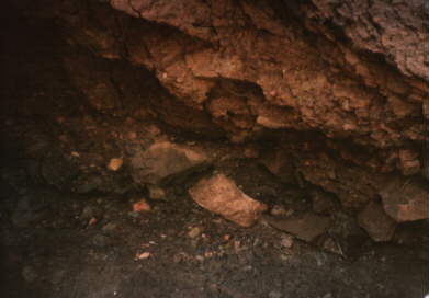
 The
INTERNAL structure members are in a much better state simply because they have
not been exposed to the elements. On the east side of the ark is a section in
which the rib timbers are exposed but have NOT completely fallen away and left
holes where they once were. However, these ARE fractured, having suffered from
"frost wedging." It was on this section that Ron and Richard performed
the "mini-excavation" in which the ribs were able to be seen due to
the color difference, even though the ribs are in a fragmented state. They are
still held in place by the soil, probably due to their angle and also some
Divine assistance.
The
INTERNAL structure members are in a much better state simply because they have
not been exposed to the elements. On the east side of the ark is a section in
which the rib timbers are exposed but have NOT completely fallen away and left
holes where they once were. However, these ARE fractured, having suffered from
"frost wedging." It was on this section that Ron and Richard performed
the "mini-excavation" in which the ribs were able to be seen due to
the color difference, even though the ribs are in a fragmented state. They are
still held in place by the soil, probably due to their angle and also some
Divine assistance.
What Caused the Color Difference
This above section is at the front of the ship on the uphill section. The substances in the water which was flowing over the ship's structures and which effected its petrification were minerals from above the ship. These minerals consisted of silica from the soil, lime and calcium, to name a few. This gave the petrified structure a "whitish" appearance, compared to the petrified remains of the lower section of the ship, which featured a darker color due to the large amount of metals in them. We have 2 specimens of petrified wood, both about 6 inches long, both 2 inches wide and 1 1/2 inches deep. They are identical, except for one thingthe piece which came from inside the crack near the front of the ship is very light colored, while the other piece is dark. They are both petrified wood pieces from the ship, only one piece's molecules were replaced by lighter colored substances than the other.
 We
found two grave markers that bore the eight-cross symbols of Noah and his family
above an ancient, petroglyphic portrayal of Noah's death on one marker and that
of his wife on the other. These grave markers were in the front of a very
ancient stone house. These markers and the house have been vandalized, and over
one hundred million U.S. dollars worth of gold and gemstones were stolen from
the graves. The Turkish authorities are seeking to recover these precious
artifacts and to punish the thieves. At present, they are aware of the identity
of the most probable person responsible for this outrage. He is a man who has
been involved in the Ark search in the past, but he dropped from the public eye
shortly after the theft from Noah's and his wife's graves.We located and
photographed several other inscriptions and physical remains of the flood and
the Ark. We got a brief look at the boat remains before we were forced to flee
for our lives. Upon our arrival back in the states, we had our super-eight movie
film developed and were delighted to see that we had good photographic
documentation of all the artifacts and inscriptions.
We
found two grave markers that bore the eight-cross symbols of Noah and his family
above an ancient, petroglyphic portrayal of Noah's death on one marker and that
of his wife on the other. These grave markers were in the front of a very
ancient stone house. These markers and the house have been vandalized, and over
one hundred million U.S. dollars worth of gold and gemstones were stolen from
the graves. The Turkish authorities are seeking to recover these precious
artifacts and to punish the thieves. At present, they are aware of the identity
of the most probable person responsible for this outrage. He is a man who has
been involved in the Ark search in the past, but he dropped from the public eye
shortly after the theft from Noah's and his wife's graves.We located and
photographed several other inscriptions and physical remains of the flood and
the Ark. We got a brief look at the boat remains before we were forced to flee
for our lives. Upon our arrival back in the states, we had our super-eight movie
film developed and were delighted to see that we had good photographic
documentation of all the artifacts and inscriptions.
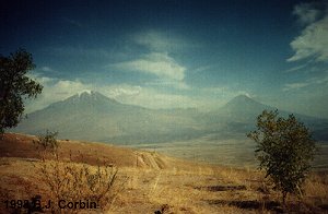
Big and Little Ararat from the Visitors Center
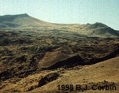
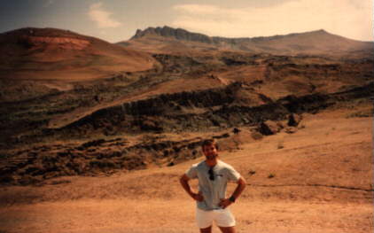
Durupinar from the Visitors Center 1998 B.J. Corbin in front of the Durupinar Site 1990
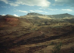
Top left side 1990 Hole blasted out 1990
DURUPINAR
(Written By B.J. Corbin who disbelieves in Ron Wyatt's discovery as of December
2002)
This boat-shaped formation gained prominence with media
attention of expeditions by Ron Wyatt and the late David Fasold. Though the site
was regarded by many early on, as only a natural formation, it still holds the
interest of several individuals and groups today. Salih Bayraktutan and Robert
Michelson are still actively engaged in researching the Durupinar site. David
Deal, a friend and colleague of the late David Fasold, is also in this camp,
though he openly admits his bias that the Durupinar site is indeed the footprint
remains of Noah's Ark. He also calls the area above Durupinar Naxuan. To be
charitable, these types of declarations are premature at best. They feel that
the criticisms of the site are not grounded in good science and they hope to
conduct in-depth experiments before making a final determination.
Keys points by those that favor the Durupinar site:
1. The shape is a "boat" exactly 300 Egyptian (20.6") cubits long
(Moses was trained in the court of the Pharaoh and would likely have used
Egyptian units, not the later Hebrew cubit (18")). Babylonian documents
place the deck area at 1 IKU. Dividing the length of the boat into the area
gives right at 50 (Egyptian) cubits average width. Certainly a most intriguing
coincidence if it is not related in some way to the Biblical Ark.
2. The "boat shape" is in the mountains of Urartu and is on one of
three mountains in Turkiye named Cudi. The Quran is specific that the Ark came
to rest on "al Cudi".
3. The places surrounding the Durupinar site bear names such as Kargakonmaz
("the crow won't land"), Masher ("Judgement Day"),
Yigityatagi ("hero's anchorage"), Ziaret ("to make a voluntary
pilgrimage"--what Josephus said people did during his day (meaning that it
was accessible to the common man)), and Nasar ("to make a sacrifice"--
what Noah did upon leaving the Ark. Note: The Babylonians refer to Utnapishtim
(Noah) being in "Nasir"), etc. etc.
4. Unlike the Ararat volcano for which no evidence has ever been substantiated
that it was under water (no pillow lava, no marine sediment, no fossils), the
Durupinar site is littered with fossils and marine sediments which prove that
this area was at one time inundated by an ocean.
5. Ancient writings speak of the Ark's place of "first decent"
(thereby implying a place of second decent). Aerial photographs from 1959 show a
boat shaped impression located around 7,300 ft at the top of a large ever moving
mud flow. At around 6,200 ft down the same mud flow is the Durupinar boat-shape
which exactly fits the impression at the top of the mud flow. At these
altitudes, organic materials would have rotted or been used for fuel and
building materials long ago. If it is at all related to the Ark, the Durupinar
site is probably the compression footprint in the natural material. -end-
|
I have now been to the Durupinar site on three separate occasions and agree that an archeological dig would answer the question once and for all. Just looking and walking around the Durupinar site, it appears to be totally natural and consistent with the surrounding landscape and material. My concern is, why after all these years of controversy has the site not been excavated and the final question answered? |
http://www.biblerevelations.org/toc.htm
http://anchorstone.com/
People
Identifying the Durupinar Site as the true remains of Noah's Ark
Wayne
McKellips - http://www.trustbible.com/ark.htm
Aaron
Sen
David Allen Deal
Donald
W. Patten
Jim Pinkoski
Kevin Fisher
Rob
Michelson
Wyatt Anchor
Stones
Wyatt Archaeological
Research
Wyatt Archaeological
Museum
People
Denying the Durupinar as the true remains of Noah's
Ark
Wyatt
Archaeological Research (WAR) Fraud Documentation
A
Great Christian Scam
Letter
from Lorence G. Collins, Ph.D., Professor of Geology (emeritus) at California
State University Northridge
Bogus
"Noah's Ark" From Turkey Exposed As A Common Geologic Structure by
Lorence Gene Collins and David Fasold (original article in the Journal of
Geoscience Education, v. 44, 1996)
Letter
from Harold G. Coffin to David Merling
Has
Noah's Ark Been Found? Part I by David Merling, Ph.D. in Archaeology
Has
Noah's Ark Been Found? Part II by David Merling, Ph.D. in Archaeology
Letter
from John Baumgardner, Ph.D. in Geophysics
Article
by John Morris, Ph.D. in Geology
Letter
from Thomas Fenner, Geophysicist
Letter from
Joe Zias, Curator of Anthropology/Archaeology, Israel Antiquities Authority
Could
this be Noah's Ark? by Andrew Snelling, Ph.D. in Geology
"Ron Wyatt: Are
His Claims Bonafide?." by Bill Crouse, President of Christian Information
Ministries
Ron Charles has a
premise that the Durupinar site was actually a Mongol Fort.